


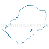
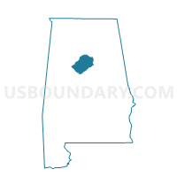
Homewood Public Library, Jefferson County, Alabama
About
Outline

Summary
| Unique Area Identifier | 522160 |
| Name | Homewood Public Library |
| County | Jefferson County |
| State | Alabama |
| Area (square miles) | 2.56 |
| Land Area (square miles) | 2.51 |
| Water Area (square miles) | 0.04 |
| % of Land Area | 98.30 |
| % of Water Area | 1.70 |
| Latitude of the Internal Point | 33.46082900 |
| Longtitude of the Internal Point | -86.79743180 |
Maps

Graphs
Select a template below for downloading or customizing gragh for Homewood Public Library, Jefferson County, Alabama


Neighbors
Neighoring Voting District (by Name) Neighboring Voting District on the Map
- Bluff Park United Methodist Church, Jefferson County, AL
- Edgewood Elementary School, Jefferson County, AL
- Election Systems and Software, Jefferson County, AL
- Homewood Exceptional Foundation, Jefferson County, AL
- Mountain Brook Elementary School Community Room, Jefferson County, AL
- Shades Cahaba Elementary School, Jefferson County, AL
- Vestavia Hills Civic Center, Jefferson County, AL
- Vestavia Hills United Methodist Church, Jefferson County, AL
Top 10 Neighboring County Subdivision (by Population) Neighboring County Subdivision on the Map
Top 10 Neighboring Place (by Population) Neighboring Place on the Map
- Hoover city, AL (81,619)
- Vestavia Hills city, AL (34,033)
- Homewood city, AL (25,167)
- Mountain Brook city, AL (20,413)
Top 10 Neighboring Unified School District (by Population) Neighboring Unified School District on the Map
- Jefferson County School District, AL (230,679)
- Hoover City School District, AL (81,093)
- Vestavia Hills City School District, AL (34,033)
- Homewood City School District, AL (25,167)
- Mountain Brook City School District, AL (20,413)
Top 10 Neighboring State Legislative District Lower Chamber (by Population) Neighboring State Legislative District Lower Chamber on the Map
- State House District 46, AL (50,398)
- State House District 47, AL (48,011)
- State House District 52, AL (43,159)
Top 10 Neighboring State Legislative District Upper Chamber (by Population) Neighboring State Legislative District Upper Chamber on the Map
Top 10 Neighboring 111th Congressional District (by Population) Neighboring 111th Congressional District on the Map
Top 10 Neighboring Census Tract (by Population) Neighboring Census Tract on the Map
- Census Tract 129.15, Jefferson County, AL (6,083)
- Census Tract 144.04, Jefferson County, AL (5,433)
- Census Tract 107.04, Jefferson County, AL (4,892)
- Census Tract 107.06, Jefferson County, AL (4,880)
- Census Tract 107.02, Jefferson County, AL (4,484)
- Census Tract 129.05, Jefferson County, AL (4,277)
- Census Tract 144.05, Jefferson County, AL (3,929)
- Census Tract 107.05, Jefferson County, AL (3,487)
- Census Tract 107.03, Jefferson County, AL (2,304)
- Census Tract 107.01, Jefferson County, AL (2,218)